


On the 28th January 2020, the UK Hydrographic Office officially handed over seabed mapping data to the Turks and Caicos Islands to support safe maritime trade and the development of a sustainable blue economy.
Almost all activity in our oceans, from shipping to monitoring delicate marine environments, depend on accurate seabed mapping data that illustrates the shape and movement of natural underwater features. So, for coastal communities like the Turks and Caicos Islands, the collection of this data is vital to supporting the safety of mariners, generating sustainable economic growth and protecting people from the effects of climate change.
As part of the UK government’s Overseas Territories Seabed Mapping Programme, the UKHO led the collection of this data through a series of seabed mapping surveys covering over 7,200km2 of ocean in 2018. Following successful completion of this work, the data has now been handed over to the government through a series of workshops. These workshops, which were led by UKHO experts, have been designed to help authorities use these findings to fulfil their international maritime safety obligations under the Safety of Life at Sea (SOLAS) Convention, as well as support sustainable development initiatives.
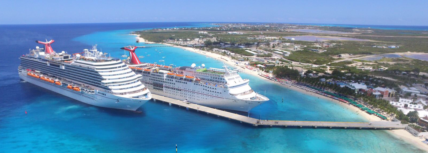
As part of the programme, the UKHO will also update nautical charts that support the safe navigation of ships accessing the nation’s trade and tourism hubs of South Dock and Grand Turk.
In addition to this, the UKHO has presented officials with other key data sets, including high resolution imagery and the topography of the islands themselves, which can be used to identify sensitive marine and wetland habitats and reef areas which make up a vital part of the island’s marine environment. With this insight, government ministries can support marine and land spatial planning activities that contribute to the development of the local economy in a sustainable manner.
All work carried out through this programme is coordinated by the Foreign & Commonwealth Office and supported by the UK’s Conflict, Stability and Security Fund (CSSF) as part of the UK’s commitment to support Overseas Territories.
The Ministry of Tourism, Environment, Maritime, Heritage, Disaster Management & Gaming, and Maritime & Shipping Department is grateful the UKHO for assisting in this milestone achievement as it satisfies a requirement for updating of hydrographic data for nautical charting, regulation 9 SOLAS Convention.
Hon. Ralph Higgs, stated that the timing of this deliverable is great, as it forms a part of our National Physical Development Planning project, and will not doubt inform this very important exercise. He noted that it would not have been possible, if not through collaborative beneficial relationships developed with UKHO, the Governor’s Office and Mapping & Survey Department.
Permanent Secretary, Cherylann Jones, co-signed the documentation taken ownership of the hydrographic data.
Also on hand to participate in the senior level briefing on the data were TCI Maritime Oversight Steering Committee, Chairs, Michelle Fulford Gardiner, Deputy Permanent Secretary and Henry Wilson, Acting Director, Maritime & Shipping Department, along with Committee Members.
NOTES
The Overseas Territories Seabed Mapping Programme
The Overseas Territories Seabed Mapping Programme is funded by the UK Government’s Conflict, Stability and Security Fund (CSSF). It is co-ordinated by the Foreign and Commonwealth Office as part of the UK’s commitment to support the Overseas Territories.
About the UK Hydrographic Office (UKHO)
The UKHO is a leading centre for hydrography, providing marine geospatial data to inform maritime decisions. We work with a wide range of data suppliers and partners to support maritime navigation, safety, security and marine development around the UK and worldwide.
We make location-based information available through ADMIRALTY Maritime Data Solutions, our world-leading range of charts, publications and custom data sets. Our use of marine data and technology, combined with our expertise, ensures we continue to innovate and provide a wider range of solutions.
We source, process and provide access to location-based information, ranging from seabed to surface. This enables our partner organisations to make critical maritime decisions – informing the sustainable use and management of the marine environment and supporting the development of the blue economy.
About TCI Maritime Oversight Steering Committee
The TCI Maritime Oversight Committee was established in 2018 to assist with the coordinating and streamlining of activities associated with the implementation of the IMO III Code and other essential maritime functions. The Group is comprised of governmental and quasi-government agencies within the TCI with Flag, Port and Coastal State responsibilities related to the implementation of the Code.
The Group is Chair by Director, Wilson, DMS & DPS Fulford Gardiner, Ministry with responsibility for Maritime
Membership is as follows:
- Governor’s Office
- Office of the Attorney General (AG), AG or Rep.
- Department of Maritime and Shipping (DMS), Director
- Port Authority (PA), Director
- Department for the Environment and Coastal Resources (DECR), Director
- Royal Turks and Caicos Police Force (RTCIPF), ACP
- Survey and Mapping Department (SMD), Director